



Every winter, UK councils face the same high-stakes question: how do you keep thousands of kilometres of roads safe when temperatures drop, conditions shift overnight, and resources are stretched thin? Gritting route optimisation is where the answer begins, but getting it right requires more than a static plan pinned to a depot wall.
This guide covers everything you need to know about planning, adjusting, and documenting gritting routes with real-time operational insight. From understanding legal duties to building dynamic routes that respond to changing weather, you will find practical frameworks and field-tested approaches used by councils across the country.
Key Takeaways: Gritting Route Optimisation for UK Councils
- UK councils must treat priority roads under the Highways Act 1980, but national guidance allows a risk-based approach to network selection.
- Static winter service plans often fail to account for real-time weather shifts, staffing changes, and infrastructure updates.
- Route-based forecasting replaces blanket domain treatments with targeted, road-specific decisions that cut salt use and emissions.
- Jewel Winter Management connects route planning, field execution, and reporting so councils can adjust routes in real time.
- Capturing driver feedback digitally during pre-season checks turns individual knowledge into a shared, scalable operational resource.
What Are Gritting Routes and Why Do They Matter?
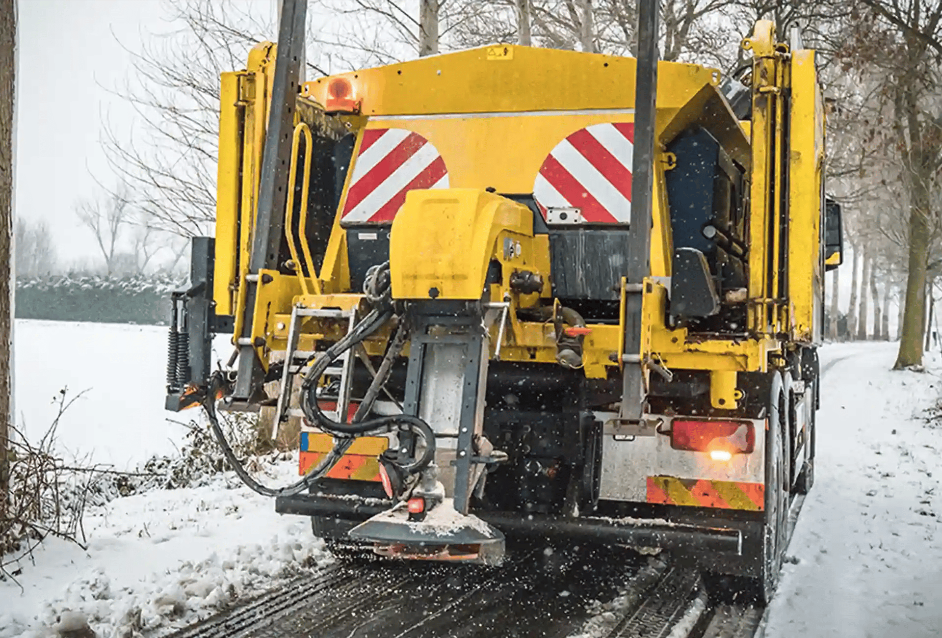
Gritting routes are predefined road networks that councils treat with salt or brine ahead of, or during, freezing conditions. These routes determine which roads receive precautionary salting and in what order, directly affecting public safety and traffic flow during winter weather.
The selection of gritting routes is not arbitrary. Councils evaluate factors such as traffic volume, road classification, proximity to hospitals and schools, public transport corridors, and known frost-prone locations. The resulting priority network typically covers between 40% and 60% of a council's total road length.
When routes are well planned, councils reduce the risk of accidents on icy roads, use salt and fuel more efficiently, and maintain public confidence in winter service delivery. When routes are poorly designed or outdated, the consequences can include missed streets, wasted resources, and increased liability.
What Are Your Legal Obligations Under the Highways Act 1980?
Section 41(1A) of the Highways Act 1980 places a duty on highway authorities to ensure, so far as is reasonably practicable, that safe passage is not endangered by snow and ice. This does not mean every road must be gritted. It means councils must demonstrate a reasonable, well-documented approach to winter service delivery.
The National Winter Service Research Group (NWSRG) provides practical guidance that most councils follow when defining their treatment networks. Key principles include prioritising high-traffic routes, maintaining access to critical infrastructure, and documenting decision-making processes clearly.
Compliance is not only about treating roads. It also involves recording what was done, when it was done, and why. Accurate logging of route completions, salt spread rates, and treatment times provides evidence that your council acted reasonably, which becomes essential if a claim arises.
How Do You Define Your Priority Route Network?
Most councils operate a tiered priority system. Priority 1 routes include A-roads, major bus corridors, access routes to hospitals, and other critical infrastructure. These are treated first, typically between 5am and 7am. Priority 2 routes cover secondary roads, residential areas with steep gradients, and routes to schools.
Defining this network starts with a systematic evaluation. Consider traffic counts at peak hours, road classification, local topography, and historical accident data during icy conditions. Councils such as North Yorkshire maintain a network covering over 4,400 kilometres across 70 gritting vehicles, while smaller authorities may manage a few hundred kilometres with a handful of vehicles.
Review your priority network annually. Road infrastructure changes, new housing developments alter traffic patterns, and budget pressures may require adjustments. West Berkshire Council, for example, recently revised its gritting route criteria to align with updated national guidance, resulting in a more targeted and defensible priority network.

Why Do Static Winter Service Plans Fall Short?
A static winter service plan treats every forecasted frost event the same way: deploy all gritters across all priority routes, regardless of local conditions. This approach was standard practice for decades, but it creates several operational problems.
First, it leads to over-treatment. Not every road on your network will reach the same surface temperature at the same time. Domain-based forecasting, which assigns a single weather forecast to an entire area, cannot capture the micro-climate variations that exist across a council's road network.
Second, static plans struggle with staffing disruptions. When a driver calls in sick or a vehicle breaks down, a rigid plan offers no easy way to redistribute work. Routes go untreated, or remaining drivers are overloaded. For councils already managing staff shortages, this creates real operational risk.
Third, paper-based or spreadsheet-driven plans make it difficult to capture and act on the operational knowledge that experienced drivers carry. That knowledge, built over years of driving specific routes, often stays with individuals rather than becoming part of the organisation's shared intelligence.
What Is Route-Based Forecasting and How Does It Improve Gritting?
Route-based forecasting is a significant step forward from domain-based approaches. Instead of applying a single weather prediction to a broad area, route-based forecasting uses data from roadside weather stations and thermal mapping to predict surface temperatures along specific road segments.
This means your decision to deploy gritters can be tailored to actual conditions on each route. One route may need treatment while another, just a few kilometres away, does not. Somerset Council recently adopted route-based forecasting and estimated an annual carbon saving of 44 tonnes through reduced salt use and fewer unnecessary deployments.
The practical benefits extend beyond environmental savings. By treating only the routes that genuinely need attention, you free up vehicles and drivers for redeployment if conditions escalate elsewhere. This creates a more responsive and flexible winter service operation.
How Do You Plan Efficient Salt Spreading Routes?
Route efficiency is about more than choosing the shortest path. An effective gritting route minimises dead mileage (kilometres driven without spreading), avoids unnecessary U-turns, and ensures drivers can complete their circuit within the agreed response time.
Start with a digital map of your treatment network. Overlay vehicle depot locations, turning restrictions, one-way streets, and known bottlenecks. Then calculate routes that cover the required roads with the fewest total kilometres, ensuring each vehicle returns to the depot for reloading within your operational window.
Pre-wetted salt, which Worcestershire Council uses across its 26 designated gritting routes, improves treatment effectiveness and reduces the total quantity of salt needed per run. Combined with GPS-controlled spread rate technology, this approach ensures consistent coverage without wastage.
What Factors Should You Consider When Designing Routes?
Road width and gradient affect vehicle speed and salt distribution. Narrow lanes in rural areas may require smaller vehicles or adjusted spread patterns. Steep hills need heavier salt application and sometimes different treatment timing.
Depot location determines how quickly vehicles can reach the start of their route. If a depot is poorly positioned relative to the priority network, response times suffer. Some councils operate from multiple depots to reduce initial travel distances.
Vehicle capacity dictates how many kilometres a gritter can cover before returning to reload. Plan routes so that reload points are logical, minimising the gap between the last treated section and the depot.

How Can Real-Time Monitoring Transform Your Winter Operations?
Knowing where your gritters are and what they have completed, in real time, changes the way you manage winter operations. Instead of waiting for drivers to return and report, you can track route progress as it happens, identify gaps, and make adjustments on the fly.
Real-time monitoring also helps you respond to escalating conditions. If a sudden temperature drop affects an area that was not initially scheduled for treatment, you can redirect the nearest available vehicle without disrupting the rest of the operation.
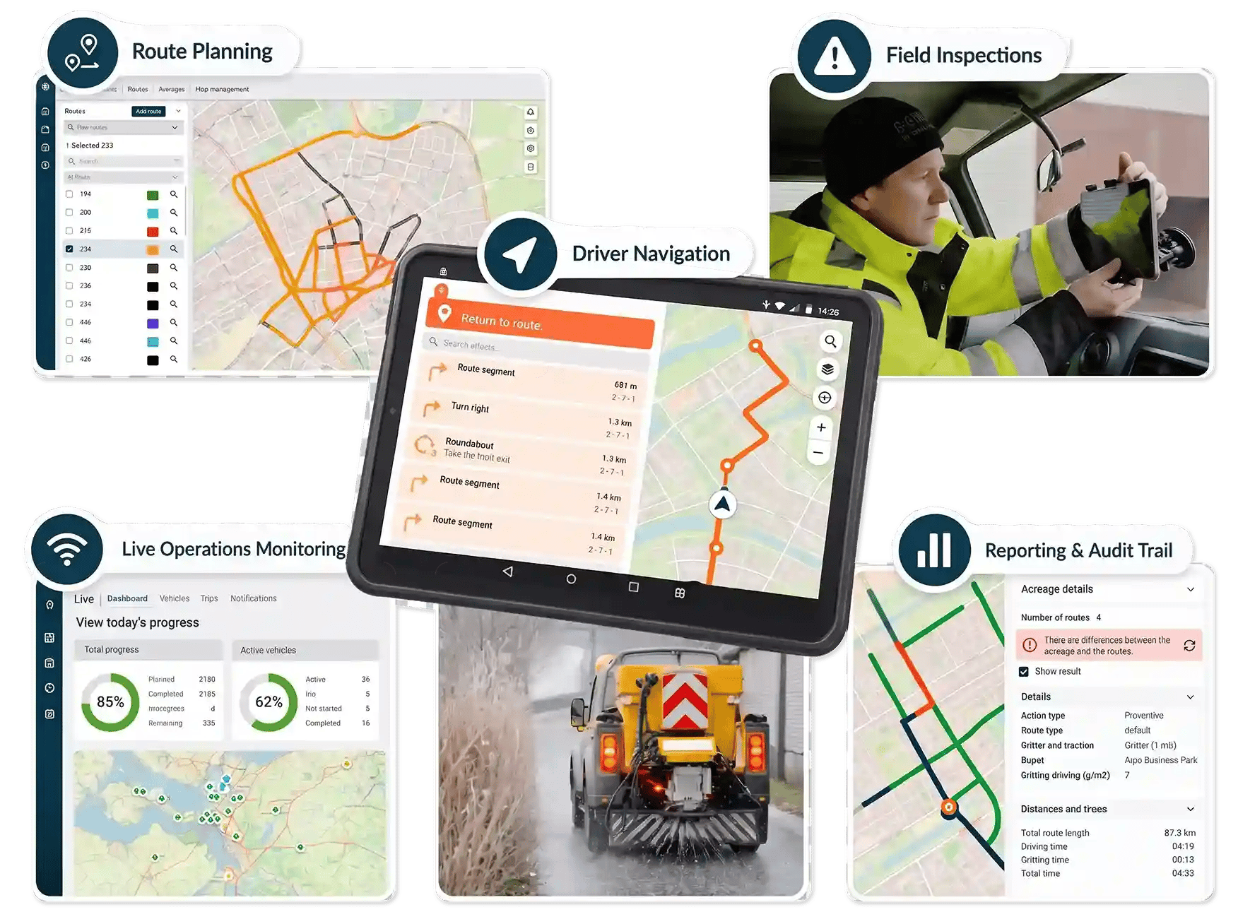
This level of visibility is where digital platforms make a practical difference. Jewel provides live dashboards that show route progress, completed treatments, and outstanding work, giving planners and managers a shared operational picture that reduces the need for phone calls and radio check-ins.
How Do You Handle Driver Shortages and Seasonal Staffing?
Winter service operations depend heavily on experienced drivers who know the routes, understand local road conditions, and can make sound judgments under pressure. When those drivers are unavailable due to illness, retirement, or competing demands, maintaining service continuity becomes a real challenge.
One approach is to reduce the dependency on individual route knowledge. When gritting routes are documented digitally with spoken turn-by-turn navigation, a replacement or seasonal driver can follow the same route accurately without prior experience of the area.
Pre-season fleet reviews offer another opportunity. By having drivers test routes before winter begins and capturing their feedback digitally, you build a knowledge base that the entire team can access. Practical observations about difficult turns, inaccessible streets, or more efficient directions of travel become part of the route itself, not locked inside one person's memory.

What Role Does Data Play in Continuous Route Improvement?
Every gritting run generates operational data: kilometres covered, salt used, time taken, routes completed, and routes missed. Over multiple winter seasons, this data reveals patterns that can drive meaningful improvement.
For example, you may discover that certain routes consistently take longer than planned because of traffic congestion at specific times. Or you may find that a particular road segment rarely reaches freezing temperatures and could be removed from the priority network, freeing up capacity for higher-risk areas.
Data also supports budget conversations. When you can show exactly how much salt, fuel, and labour each route consumes, you can build evidence-based cases for resource allocation or service redesign.
How Do You Prepare for Severe Weather Events?
Severe weather pushes winter operations beyond routine precautionary salting. Prolonged freezing, heavy snowfall, or freezing rain require escalation protocols that expand treatment beyond your primary network.
Build a tiered escalation plan. Define which additional routes receive treatment when conditions move from moderate to severe. Identify mutual aid agreements with neighbouring councils and contractors who can provide additional vehicles or drivers during extended events.
Communication is critical during severe weather. Residents, elected members, and partner organisations all need timely updates on which roads have been treated and which are still awaiting attention. A digital system that automatically logs treatments and provides a live overview makes this communication far more reliable than manual reporting.
What Should Your Severe Weather Protocol Include?
Define clear trigger points: at what forecast temperature or snowfall depth do you escalate from routine to extended operations? Assign roles and responsibilities for each escalation level, including who authorises additional deployments and who communicates with the public.
Ensure your salt stocks are sufficient. Highland Council, for example, stockpiles 50,000 tonnes of salt ahead of each winter season, distributed across 23 depots. Calculate your salt requirements based on historical usage, planned network coverage, and a contingency buffer for prolonged events.
Test your escalation plan through tabletop exercises before the season begins. These exercises help identify gaps in communication, resource availability, and decision-making processes before real pressure arrives.
How Can Technology Support Gritting Route Optimisation?
Technology is most valuable when it connects the different parts of a winter operation that traditionally work in isolation: planning, execution, reporting, and continuous improvement.
Digital route planning tools allow you to build, test, and adjust routes on screen before a single vehicle leaves the depot. GPS tracking provides real-time visibility of vehicle positions and treatment activity. Automated logging captures every action for compliance reporting without requiring drivers to fill in paper forms.
Jewel Winter Management brings these capabilities together in one platform. Route planning, spoken navigation for drivers, real-time progress monitoring, and complete operational reporting all connect through a single shared system. This means planners, drivers, and managers work from the same information, reducing miscommunication and enabling faster responses when conditions change.
How Do You Reduce Environmental Impact While Maintaining Safety?
Salt is essential for road safety, but it also affects the environment. Excess salt can damage roadside vegetation, contaminate watercourses, and corrode infrastructure. Reducing salt use without compromising safety is a growing priority for UK councils.
Pre-wetted salt technology is one proven approach. By treating dry salt with a brine solution before spreading, you improve adhesion to the road surface and reduce bounce and scatter. Worcestershire's fleet uses this method to cut salt consumption while maintaining effective coverage across 2,100 kilometres of priority roads.
GPS-controlled spreaders that adjust spread rates automatically based on road type and width prevent over-application. Combined with route-based forecasting, which targets treatments to roads that genuinely need them, these technologies help councils meet both their safety obligations and their environmental commitments.
How Do You Build a Culture of Continuous Winter Service Improvement?
The councils that perform consistently well in winter service share a common trait: they treat each season as an opportunity to learn and improve, not just a period to survive.
Post-season reviews are essential. Bring together planners, drivers, supervisors, and contractors to evaluate what worked and what did not. Review route performance data, identify recurring issues, and agree on specific changes for the following season.
Invest in pre-season preparations that go beyond vehicle inspections. Use this time to test routes, capture driver feedback, and update your digital route plans. The knowledge gathered during these reviews ensures that improvements carry forward, even when team members change.
In Conclusion: Building a Resilient Gritting Operation for Your Council
Effective gritting route optimisation is not a one-time exercise. It is an ongoing process of planning, executing, monitoring, and refining your winter service operation based on real-world data and field experience.
The shift from static plans and paper-based processes to dynamic, data-driven operations gives your council the flexibility to respond to changing conditions, the transparency to demonstrate compliance, and the efficiency to make responsible use of public resources.
Whether you are reviewing your priority network, exploring route-based forecasting, or looking for a platform that connects your entire winter operation, the principles in this guide provide a practical foundation to build on. Explore how Jewel Winter Management supports councils in planning, executing, and continuously improving their gritting operations.

FAQs About Gritting Route Optimisation for UK Councils
What is gritting route optimisation?
Gritting route optimisation is the process of designing and refining salt spreading routes to maximise road coverage while minimising fuel use, salt consumption, and driver time. It involves evaluating road priorities, vehicle capacities, depot locations, and real-time weather data to create efficient treatment plans.
How often should councils review their gritting routes?
Councils should review gritting routes at least once a year, ideally during pre-season preparations. Road infrastructure changes, new developments, and budget adjustments all affect route design. Jewel Winter Management helps teams capture driver feedback and route data digitally, making annual reviews more efficient and thorough.
What is the difference between domain-based and route-based forecasting?
Domain-based forecasting applies a single weather prediction to a broad geographic area, treating all roads the same. Route-based forecasting uses roadside sensors and thermal mapping to predict conditions along specific road segments, enabling targeted treatment decisions that reduce unnecessary salt use.
How can councils maintain gritting service when experienced drivers are unavailable?
Digital route documentation with spoken turn-by-turn navigation reduces dependency on individual driver knowledge. Jewel provides voice-guided route instructions that allow replacement or seasonal drivers to follow gritting routes accurately, even without prior experience of the area.
What data should councils track during winter gritting operations?
Key data points include kilometres covered, salt quantity used, treatment start and completion times, route deviations, and missed streets. Jewel automatically logs this information during each gritting run, creating a reliable record for compliance reporting, performance analysis, and continuous route improvement.
How does gritting route optimisation help councils reduce costs?
Optimised routes reduce dead mileage, lower fuel consumption, and prevent over-application of salt. By targeting treatments to roads that genuinely need attention, councils avoid unnecessary deployments. This evidence-based approach helps justify budget allocations and demonstrates responsible use of public funds.

No Comments Yet
Let us know what you think